Research Areas
With geophysical methods we susccessfully detect a wide range of archaeological contents from differenet archaeological periods, explain geological structure and lithology for differrent research purposes (environmental, geological, geomechanical, engineering …) and locate the underground infrastructure.
Geophysical research strategy is determined for each research separately, depending on the physical characteristics of the target objects, their size and depth, regarding the specific circumstances of the environment in which they are located. It is also important to take into account the complementarity of the results of individual methods that contribute to the insight into changes in certain physical parameters in the subsurface medium. With this multi-method approach using more, in the physical sense independent methods, we can usually expect more reliable results.
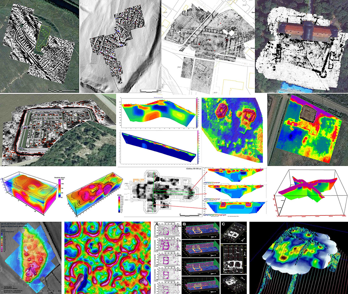
Archaeology
Geophysical research is successfully used to detect a wide range of archeological remains including their shape, depth and composition:
- settlement structures: walls, terraces, burnt clay layers, stone foundations of houses, hearts/fireplaces remains, dump pits, waste dumps and landfills, paths …,
- graveyards / necropoleis: flat cremation graves, tombs/crypts, burrial mounds and stone made chambers …,
- defence systems: ramparts, defence walls, towers, ditches …,
- craft areas: potters and blacksmith workshop areas, kilns, furnaces, slag deposits …,
- in addition to the above-mentioned archaeological structures, we get to a certain extent an insight into the geoarchaeological characteristics of the site; on the basis of the ERT and GPR results we can estimate the sediment/soil thickness and depth to a compact geological bedrock.
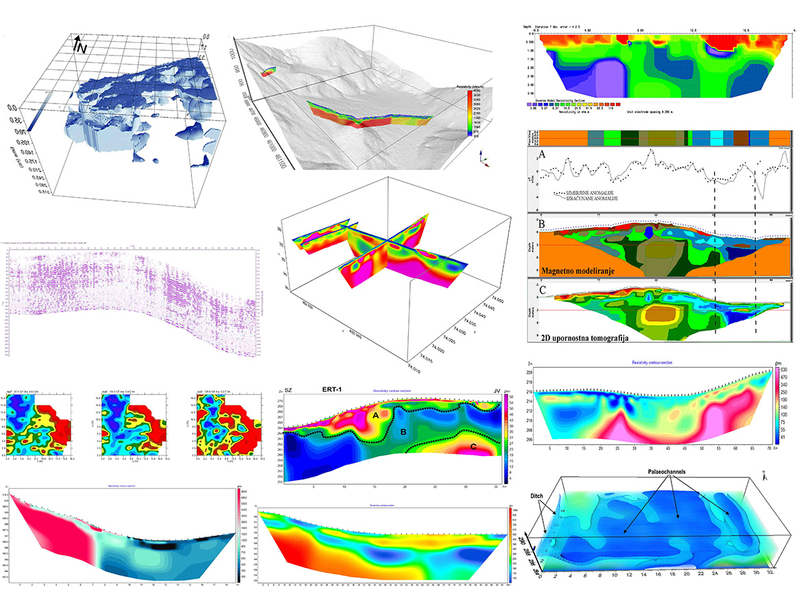
Geology and the environment
With geophysical research we successfully identify geoelogical structure and lithology of a specific area for geological, geomechanical, environmental and engineering geological studies:
- explaining the geological structure of the site,
- determining the thickness of the weathered material and/or sediment over a compact geological base,
- identification of covered faults and fault zones,
- detection of karst caves, caverns, sinkholes and dolines,
- determining the form and composition of landslides and assessing potential slipping zones,
- determination of the groundwater level and fluctuations,
- identification of the geomechanical properties of the area,
- locating abandoned mine shafts, trenches and tunnels,
- detection of hidden landfills,
- identifying the areas affected by uncontrolled spills …
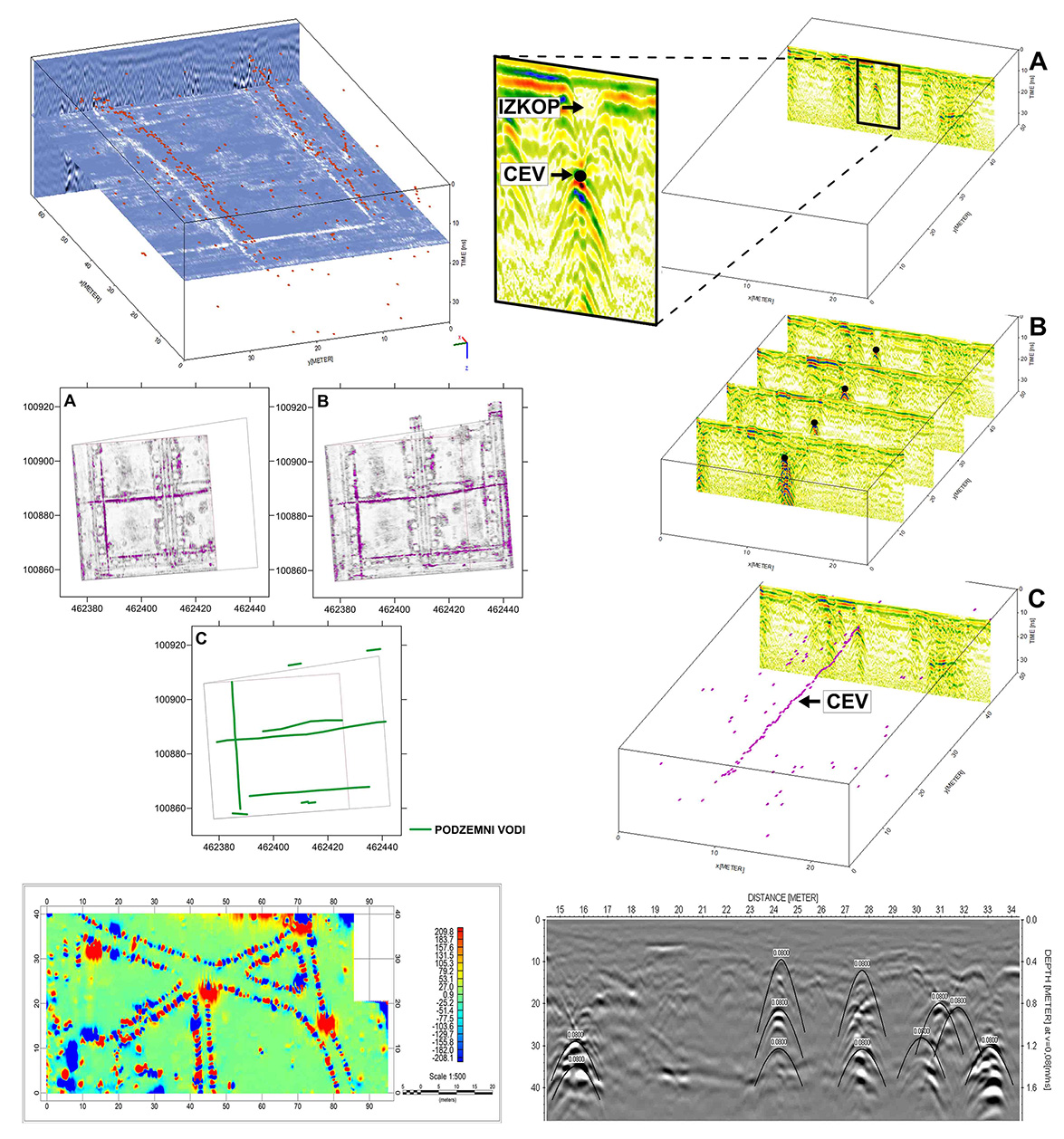
Subsurface utilities
Geophysical research is the only effective alternative to digging to determine the position of subsurface utilities. For this purpose, the magnetic, low-frequency electromagnetic and georadar method are used. In urban environments, only the georadar method is used, whereby the antennas of the corresponding frequencies are determined according to the material, depth and diameter of the pipes.
Reasons for the use of the georadar method in the detection of subsurface utilities in urban environments:
- non-destructive checking of the position and depth of underground pipes registered in the GJI Regional Cadastral for updating of the data in the collection registry (GIS) or for searching and eliminating damages,
- vertical and horizontal precision of determining the location of underground pipes in principle meets the criteria of the Regional Cadastral GJI; this applies both to energy (electricity, gas and heating) and municipal infrastructure (water supply and sewage), as well as to other networks and facilities in public use (electronic communications),
- with the georadar method, in the design phase of construction work, we can in the short term review the extensive areas foreseen for new buildings or communal reorganization, thus avoiding possible problems in the construction phase,
- there is no need for traffic circuits in urban centers, they are very short-lived; because the measurements do not produce any noise, they can also be carried out at night, if necessary,
- since measurements are made from today’s surface, unintentional damage of pipelines is completely excluded,
- the process is cheaper and faster than all other invasive methods for detecting groundwater.